Map
The startscreen
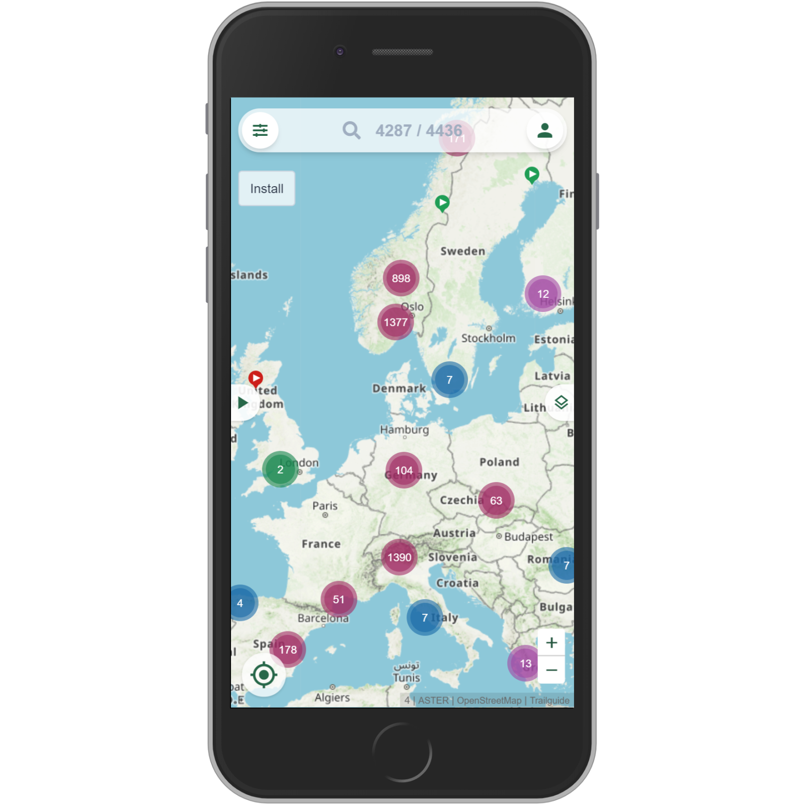
The trailguide start screen shows an overview of Europe.
The numbers in the circles are the number of tracks in the area.
You can zoom the map by clicking the circles, using pinch gestures, clicking the plus and minus buttons, or double clicking the map.
The default content category is "MTB singletracks".
Trails
When you zoom in you start seeing individual tracks.
The start of the track is marked with a trailhead and a play icon.
The color of a track indicate its technical difficulty.
Green is easy, blue intermediate, red difficult, and black is very difficult.

Infobar
Click on a trail to open the info bar.
The info bar shows the name, length, ascent, descend and portions of the description of the track.
The rather strange top of the info bar is the height profile. Move your finger along the height profile to see the same point on the map. This is a nice way to indicate the direction of the track.
Click on the info bar to open the activity page with detailed information.
Read more about the activity page here
