Trailguide 2024 Spring Edition
 Bjørn Jarle Kvande, 17. May 2024
There are small changes and improvements to Trailguide almost every day that you might not notice, but which makes the experience a little better. However, every spring we bring you a new edition of Trailguide. Check out what is new this spring which can make your mountain biking experience even better than before.


Create lists of trails and tours for any purpose
If you ever browsed around in Trailguide and came upon a trail that you really wanted to ride, but then forgot about it and what the name was? Now we have a solution for that. Easily create "playlists" in Trailguide and add any trail to it so you can access it later.
You can mark any trail you have ridden as ridden to keep track of them. You can add trails to a favorites list for other people to see which ones you really liked.
We have much more planned on the road map for this feature, but we are so excited we wanted to get it out the door as quickly as we had something useful for you.
Find out what your trail is made of
We all want really nice dirt trails, right? When looking for trails to ride, it might be difficult from just looking at the map and the track what type of trail it is. Is it a singletrack, a dirt road, or does it consist of gravel or tarmac?
When inspecting a trail in the app, you can now show the waytype and surface type of the trail and where it is. Just click on the map layer symbol in the map and turn on "Waytypes".
Mouse over the segments to see a popup with a description of the waytype.
Click the "i" icon below the map layer icon to show the legend with an explanation of the different waytypes.

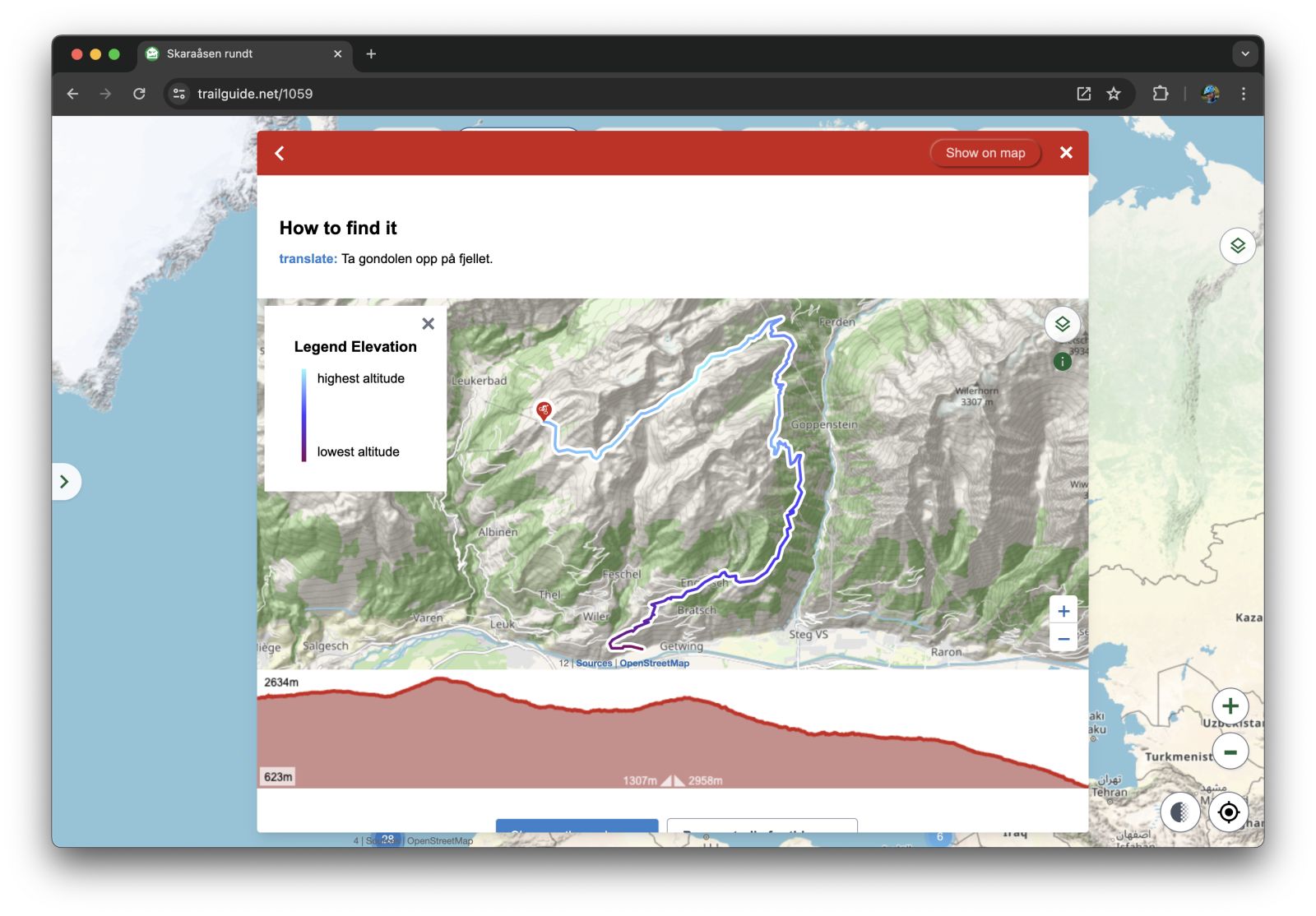
The lay of the land
In addition to the height profile in the trail description map we also added a way to visualize the elevation of the track on the track itself. Just click on the map layer symbol in the map and turn on "Elevation".
Update 2023
See last years update with many useful features to find the best MTB singletracks:

Install Trailguide | Make GPS work on iPhone | Navigation on iPhone