TRAILGUIDE
DIGITALIZING TOURISM

Trailguide 2023 Spring Edition

author profileBjørn Jarle Kvande, 18. May 2023

At Trailguide, we are committed to providing you with the best trail biking experience possible. Our app is continuously evolving, with new features and possibilities being added constantly.


However, we must admit that we haven't been the best at keeping you informed about all the exciting updates. That's why we're here to share some of the remarkable features available in the app, empowering you to discover exceptional trails and navigate them effortlessly.

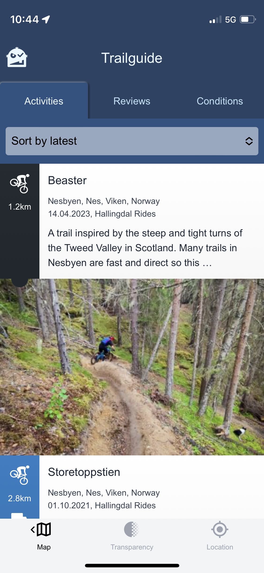
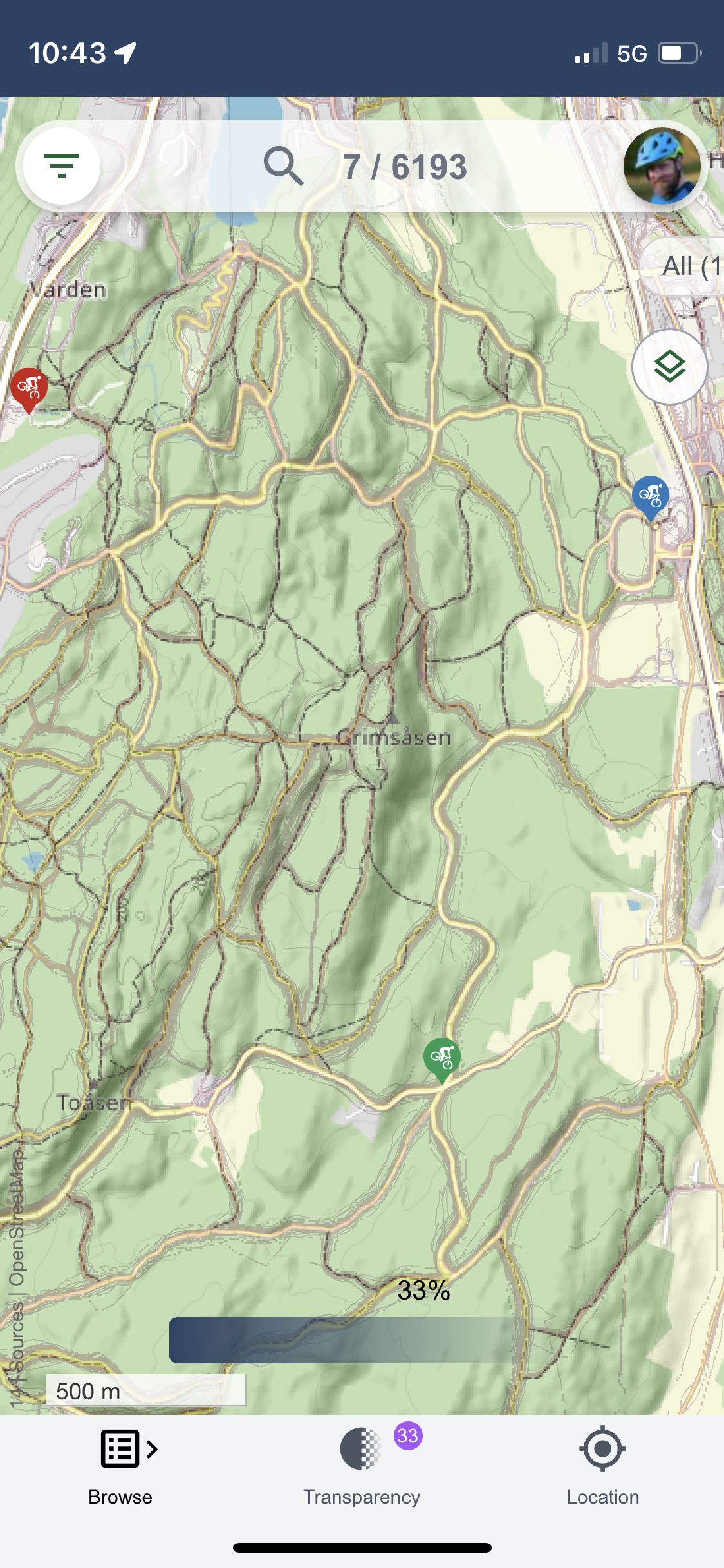
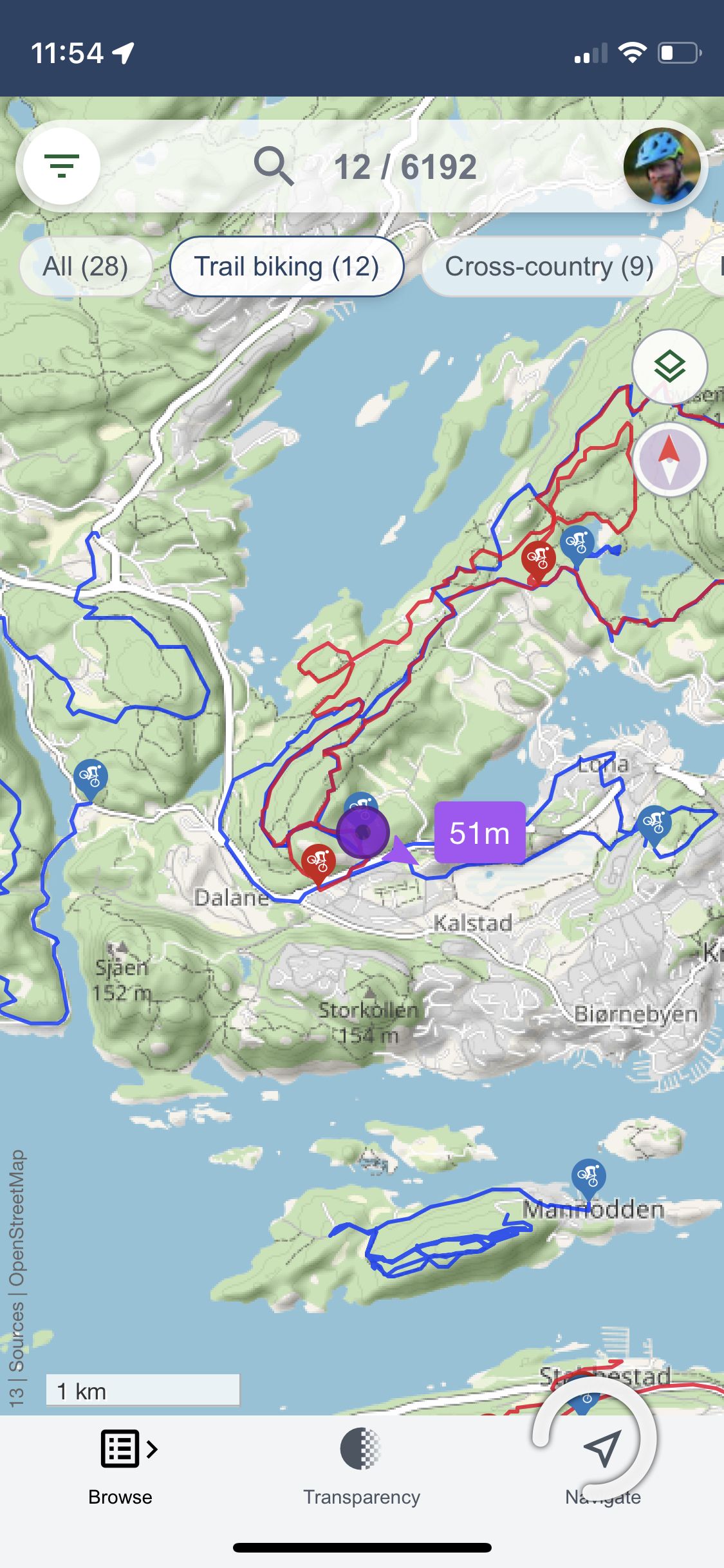
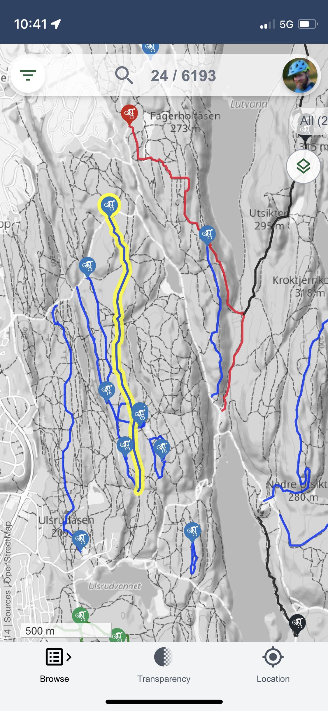
Explore our vast collection of meticulously curated trails, spanning a wide range of difficulty levels and terrains. Whether you're a beginner seeking a leisurely ride or an experienced thrill-seeker craving an adrenaline rush, Trailguide has the perfect trail waiting for you.

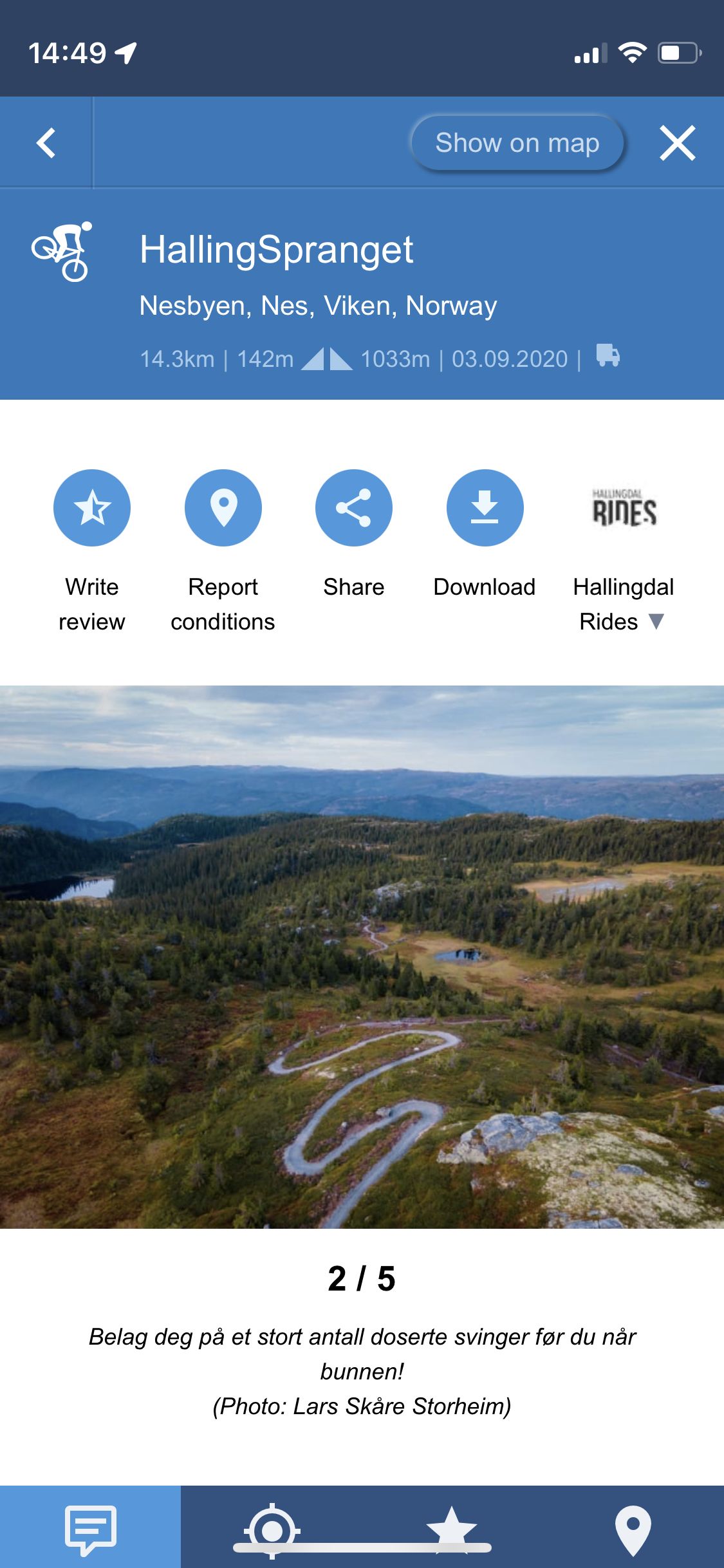
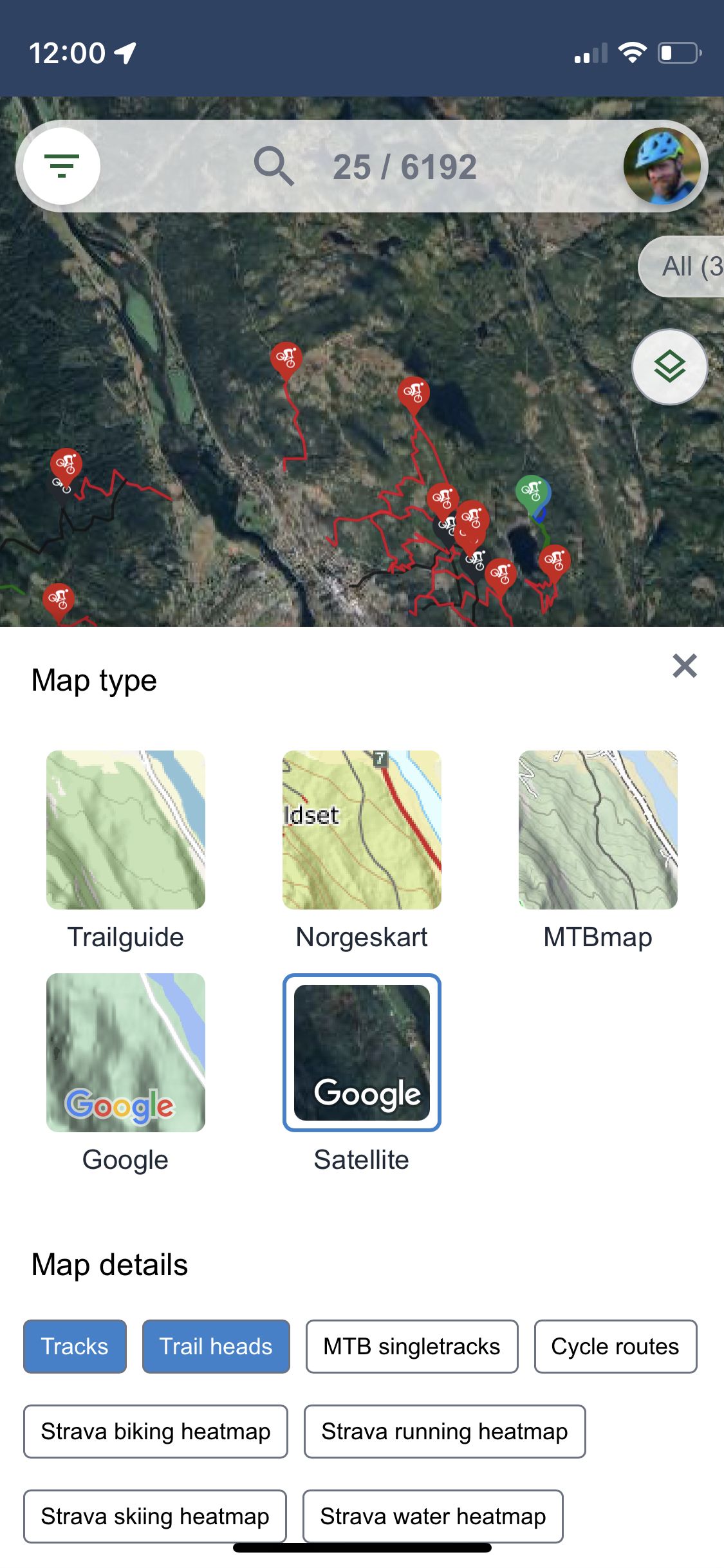
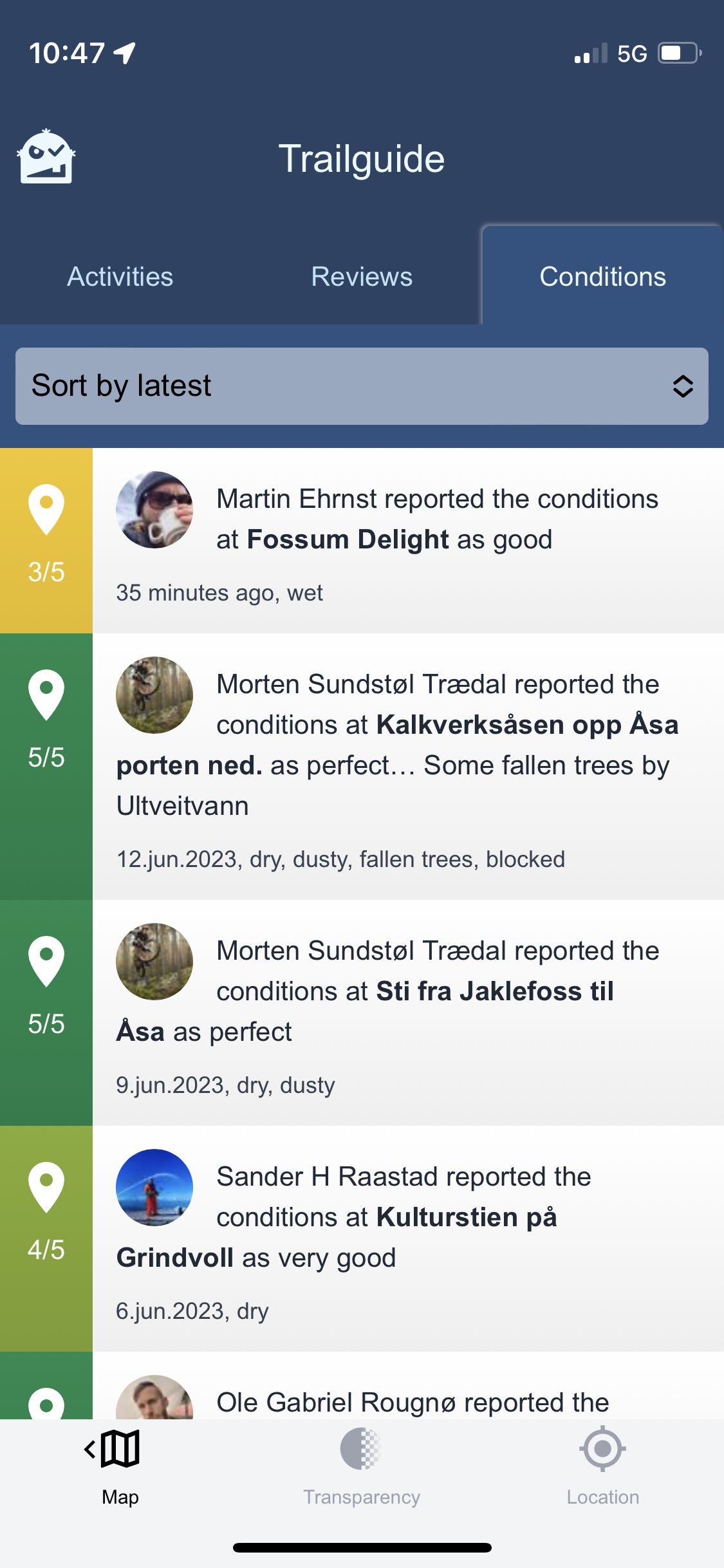
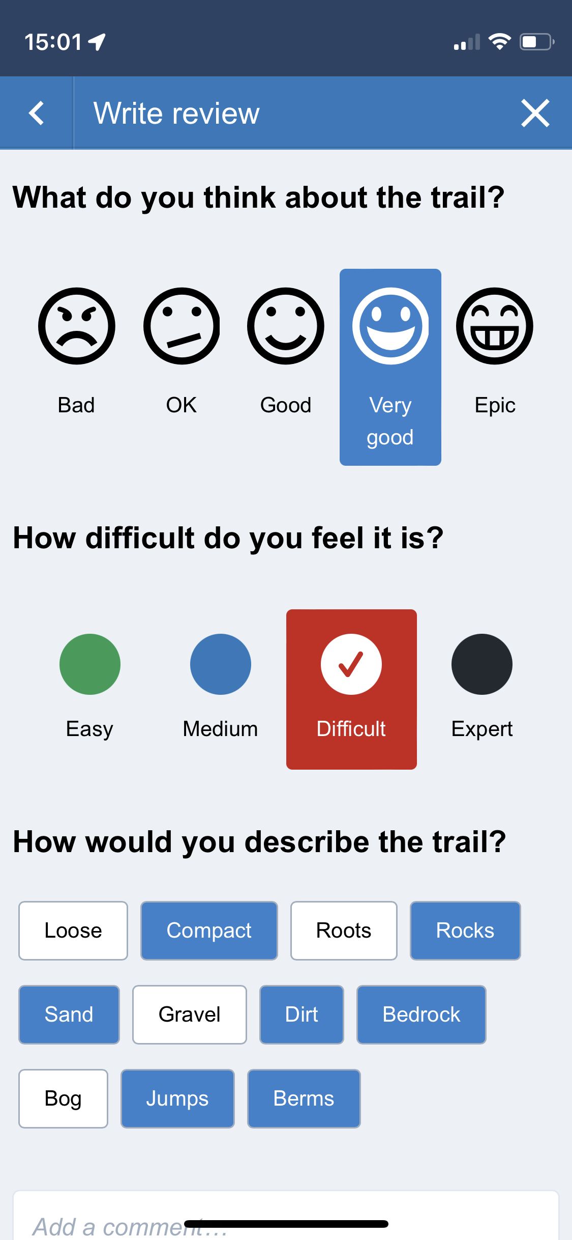
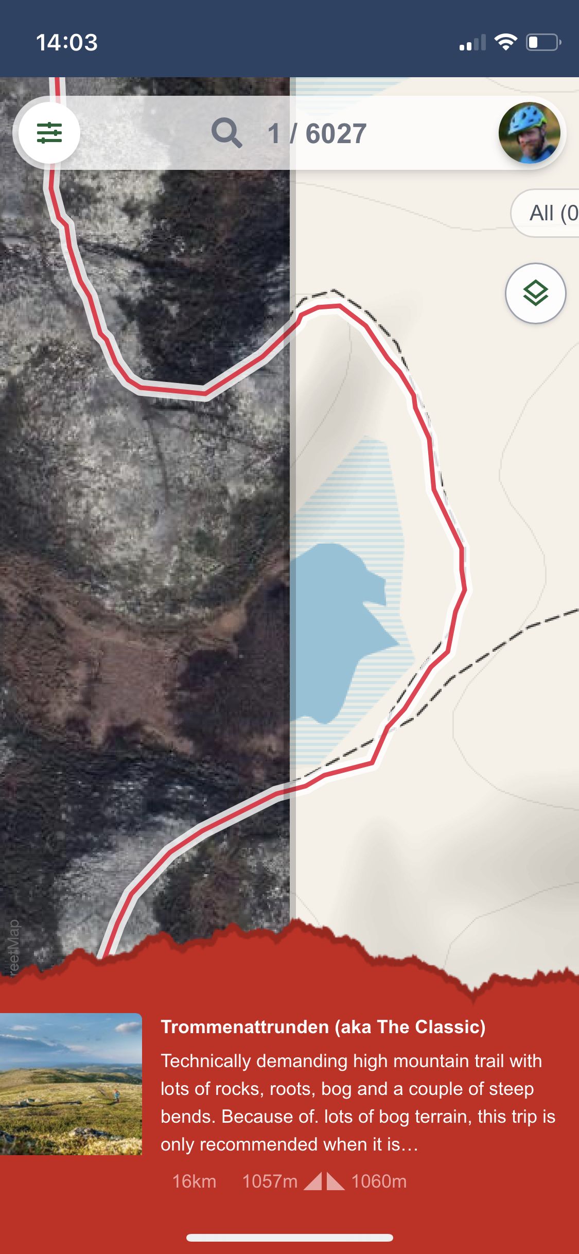
Dive into comprehensive trail descriptions, including detailed maps, images, videos, distance information, height profiles, reviews and condition reports.

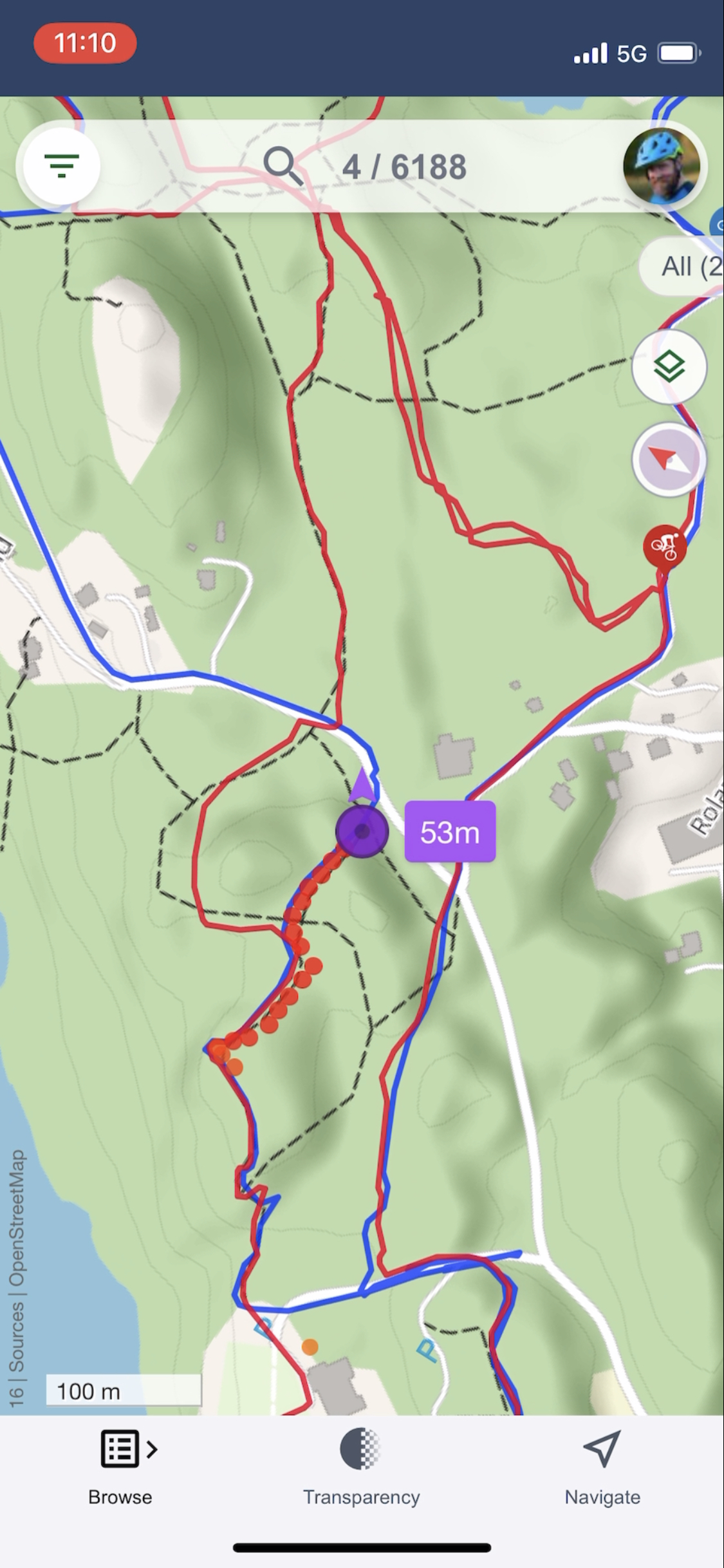
Say goodbye to getting lost. Trailguide provides great tools for better navigation, keeping you on track and ensuring a seamless journey. No more second-guessing or wasting time on unnecessary detours.

If you are not a user yet, join the Trailguide community today and unlock a world of trail biking possibilities. With our continuously expanding features and user-friendly design, your biking adventures will reach new heights.

Note: Remember to enable location services to enjoy all the features of the app.
Happy Trails,
The Trailguide Team


Install Trailguide | Make GPS work on iPhone | Navigation on iPhone

Trailguide map

iphone frameTrailguide 2023 Spring Edition
The main screen of Trailguide with the map filled with trails.

List of trails

iphone frameBrowse trails, reviews, and condition reports within the current map section
Browse trails, reviews, and condition reports within the current map section

Trail details

iphone frameLots of details are available for trails, including images and videos
Lots of details are available for trails, including images and videos

Mark trail

iphone frameClicking 'Show on map' in the trail description will mark it yellow on the map
Clicking 'Show on map' in the trail description will mark it yellow on the map

Height profile

iphone frameDrag your finger across the height profile to see where on the track the ups and downs are
Drag your finger across the height profile to see where on the track the ups and downs are

Hide categories

iphone frameHide the category selector out of the way if you want more map space
Hide the category selector out of the way if you want more map space

Transparency

iphone frameUsing the transparency adjuster you can check what is underneath the trail marking - is it a trail or a gravel road?
Using the transparency adjuster you can check what is underneath the trail marking - is it a trail or a gravel road?

Navigation mode

iphone frameTurn on navigation mode for the location indicator to follow you and show your current direction
Turn on navigation mode for the location indicator to follow you and show your current direction

Breadcrumbs

iphone frameIn navigation mode breadcrumbs will indicate where you have been to help you find where to go
In navigation mode breadcrumbs will indicate where you have been to help you find where to go

Heading up

iphone frameClick the compass needle to toggle between north-up or heading-up
Click the compass needle to toggle between north-up or heading-up

Toggle mode

iphone frameClick for more than 1 second on the location icon in the nav bar to toggle between navigation mode and normal mode
Click for more than 1 second on the location icon in the nav bar to toggle between navigation mode and normal mode

Map selector

iphone frameSelect between different base maps and map details such as strava heatmaps, MTB tracks and cycle routes
Select between different base maps and map details such as strava heatmaps, MTB tracks and cycle routes

MTBmap.no

iphone frameUse MTBmap as the base map (only works in Norway and for limited zoom levels)
Use MTBmap as the base map (only works in Norway and ifor limited zoom levels))

OSM MTB tracks

iphone frameSame dataset as the mtbmap base layer, but it works all over the world and for any zoom level
Same dataset as the mtbmap base layer, but it works all over the world and for any zoom level

Strava heatmap

iphone frameUse the Strava heatmap to help you find popular or hidden trails. Unfortunately, the heatmap is limited to zoom level 11 and below.
Use the Strava heatmap to help you find popular or hidden trails. Unfortunately, the heatmap is limited to zoom level 11 and below.

Cycle routes

iphone frameShow cycle routes from OpenStreetMap to help you find your way on a road bike
Show cycle routes from OpenStreetMap to help you find your way on a road bike

Grayscale map

iphone frameSet the map to grayscale to better see the available trails
Set the map to grayscale to better see the available trails

Satellite map

iphone frameUse the satellite base map to see what is really on the ground
Use the satellite base map to see what is really on the ground

Trail reviews

iphone frameSee what others have said about the trail
See what others have said about the trail

Condition reports

iphone frameCheck recent condition reports within the current map section
Check recent condition reports within the current map section

Leave a review

iphone frameLeave a review and let others know what you think about a trail
Leave a review and let others know what you think about a trail

Leave a report

iphone frameLeave a condition report and let others know if it is muddy or dry
Leave a condition report and let others know if it is muddy or dry

Search

iphone frameSearch for places, trails, users and destinations
Search for places, trails, users and destinations

Filter

iphone frameFilter content by difficulty and good reviews and condition reports
Filter content by difficulty and good reviews and condition reports

Split map

iphone frameYou can split the map in two halves if you want to investigate if a marked trail on the map really is worth exploring
You can split the map in two halves if you want to investigate if a marked trail on the map really is worth exploring

Local services

iphone frameFind information and details about businesses in the area
Find information and details about businesses in the area